HydroSHEDS
Hydrological data and maps based on SHuttle Elevation Derivatives at multiple Scales
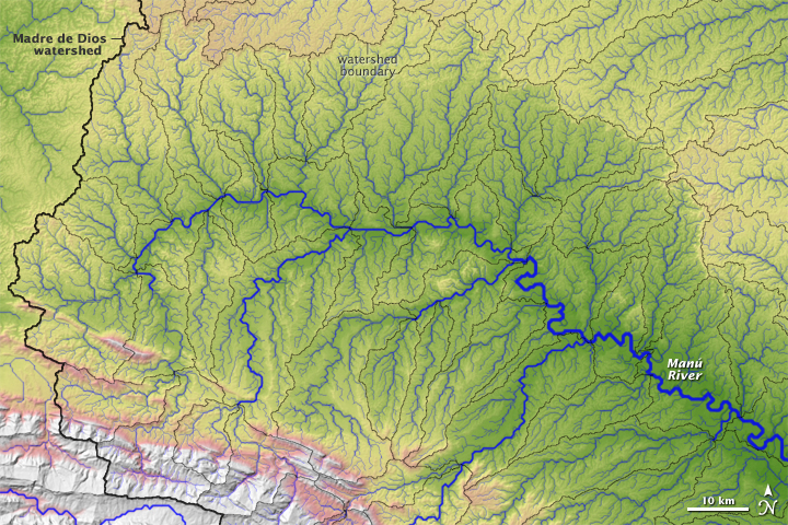
HydroSHEDS is a mapping product that provides hydrographic information for regional and global-scale applications in a consistent format. It offers a suite of geo-referenced data sets (vector & raster) at various scales, including river networks, watershed boundaries, drainage directions, and flow accumulations. HydroSHEDS is based on high-resolution elevation data obtained during a Space Shuttle flight for NASA’s Shuttle Radar Topography Mission (SRTM).
Scientific publications
Lehner, B., Verdin, K., Jarvis, A. (2008): New global hydrograhy derived from spaceborne elevation data. Eos, Transactions, AGU, 89(10): 93-94.
Data
All HydroSHEDS data is available from the HydroSHEDS website.
Project contact
For more information on this project contact Dr. Bernhard Lehner