GIEMS-D15 : Global Inundation Extent from Multi-Satellites – Downscaled 15 arcseconds
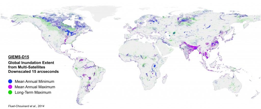
Temporarily or seasonally inundated habitats such as wetlands and floodplains are recognized as irreplaceable biodiversity hotspots. Current surface water estimates, however, possess a coarse spatial resolution inadequate for many ecological applications. In this project, a high-resolution Global Inundation Map (GLIN) was downscaled from a coarse resolution satellite time series of surface water measurements, using a topographically-derived global inundation probability map (see Fig. top). GLIM represents water extent at three time scales (Fig. bottom), making it the first temporally explicit global map of surface water extent.
Data download
GIEMS-D15 is available at Estellus.
Related Publications
Fluet-Chouinard E., Lehner B., Rebelo L.M., Papa F., Hamilton S.K. (2015): Development of a global inundation map at high spatial resolution from topographic downscaling of coarse-scale remote sensing data, Remote Sensing of Environment. 158: 348-361. doi:10.1016/j.rse.2014.10.015