HydroATLAS
HydroATLAS offers a global compendium of hydro-environmental sub-basin and river reach characteristics derived from existing global datasets at 15 arc-second resolution.
HydroATLAS is a comprehensive database gathering and presenting a wide range of hydro-environmental attributes from existing global datasets in a consistent and organized manner. HydroATLAS is divided in two datasets, BasinATLAS and RiverATLAS, which represent sub-basin delineations (polygons) and the river network (lines), respectively. HydroATLAS offers attributes grouped in seven categories: hydrology; physiography; climate; land cover & use; geology & soils; and anthropogenic influences. Version 1.0 of HydroATLAS includes a total of 56 hydro-environmental variables, partitioned into 281 individual attributes, that are derived from recent published sources.
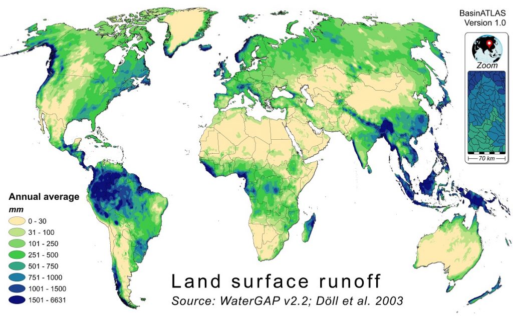
Land surface runoff, one of the catchment characteristics available in the HydroATLAS database, applied to global sub-basins
Technical documentation
For more information, please refer to the HydroATLAS Technical Documentation and the associated BasinATLAS Catalog and RiverATLAS Catalog, respectively. Note that higher resolution versions of the catalogs are available on the figshare data download site.
Data download
HydroATLAS data are available for download in different formats from the HydroSHEDS website at https://www.hydrosheds.org/page/hydroatlas and as a static copy from the figshare data repository at https://doi.org/10.6084/m9.figshare.9890531.
Reference
Linke, S., Lehner, B., Ouellet Dallaire, C., Ariwi, J., Grill, G., Anand, M., Beames, P., Burchard-Levine, V., Maxwell, S., Moidu, H., Tan, F., Thieme, M. (2019). Global hydro-environmental sub-basin and river reach characteristics at high spatial resolution. Scientific Data 6: 283. doi: 10.1038/s41597-019-0300-6 (open access)